
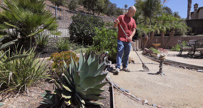
 Jeff Moore rakes the zen garden included in his back yard landscape plot plan. Photo: San Diego County Water Authority
Plan For Success: Create A Plot Plan
Any WaterSmart landscape makeover starts with observing and recording your property as it exists today. Think of it as a bird’s eye view or satellite map showing your property’s boundaries and physical features. This becomes the basis of all your planning.
You need a few basic tools to draw your own plot plan. They include a tape measure for accurate measurements, a ruler to measure and draw straight lines, a clipboard, a pencil, and paper, preferably one-quarter inch grid graph paper.
Steps to create a basic plot plan
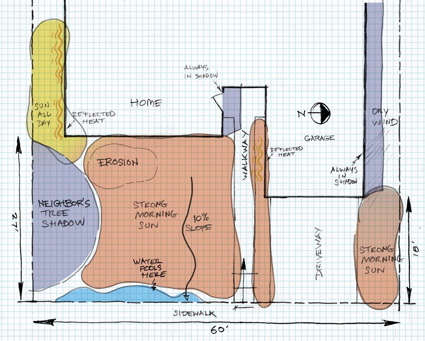
Even if you don’t plan to install the whole project at once, you should create a complete master plan for your landscape, so the outcome is unified, including a WaterSmart planting and irrigation design. Graphic: San Diego County Water Authority
- Start at the corner of your property.
- Measure across to the edge of your drive or sidewalk to your property line. Say, for example, the distance from the corner of your lot to the driveway is 28 feet 8 inches. Using the scale one-quarter inch = one foot, you would use 28 and a half squares for the space on your graph paper.
- Next, measure the depth of your property to the sidewalk or curb. Use this approach to locate property lines, walkways, trees, driveways, easements, and your home.
- Measure and mark any existing hardscape or landscape you want to save, such as walkways, mature trees, and shrubs.
- Use a ruler to draw your shapes and keep your scale accurate.
- Take note of natural drainage features. Preserving these and limiting the use of impermeable surfaces in your landscape will minimize runoff and maximize site water infiltration.
- Add compass directions to understand the sun’s shade effects as it moves across your yard. South-facing exposures are sunny and hot, while north-facing exposures can be cool and shady.
- Locate views that should be preserved and areas you want hidden from view, like your neighbor’s garbage cans.
- Locate features on your house such as windows, doors, and other openings. Indicate their height off the ground.
- Locate utilities like the water meter, electrical boxes, and overhead power lines.
- Note any existing irrigation heads. You’ll need to know where these are later when designing your new irrigation plan.
Now you have a road map of your landscape. Your future landscaping plans start with this baseline document.
Walk in the sun
As a part of creating a plan, take time to walk around your property during different times of day. Note areas that are sunny or shady in the morning and areas that are sunny or shady in the afternoon. When you start choosing your plants, make sure to select those appropriate to your garden’s sunlight patterns.
___________________________________________________

(Editor’s Note: The San Diego County Water Authority and its 24 member agencies offer programs, resources, and incentives to improve water-use efficiency for residential, commercial, and agricultural users. WaterSmart choices are a way of life in the region. Stay WaterSmart San Diego! For more water-use efficiency resources, go to WaterSmart.SD.org.)

