Posts

Atmospheric River Storm Observations Take Flight Over Pacific Ocean

Research on atmospheric rivers takes flight as UC San Diego’s Center for Western Weather and Water Extremes taps “Hurricane Hunter” aircraft for specialized scientific missions.

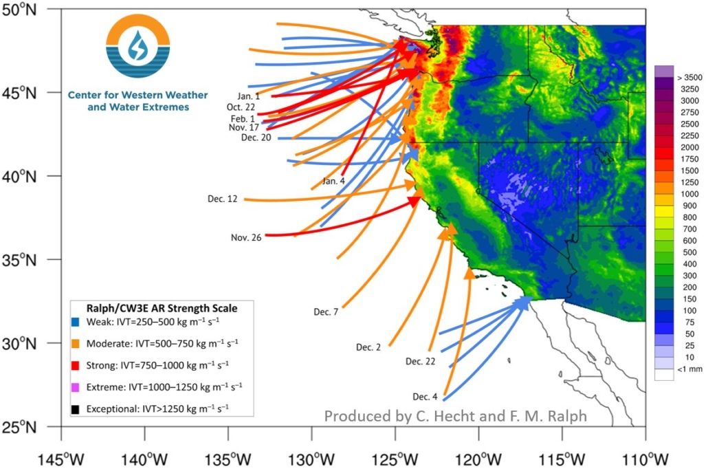
The aircraft will fly for a 13-week period (that began January 5) to glean critical data for improving forecasts of atmospheric river storms over the Pacific Ocean. Those storms, or “AR’s,” provide up to half of the U.S. West Coast’s annual precipitation and a majority of the flooding.

From Droughts to Flooding, Here’s How California is Trying to Better Understand Atmospheric Rivers

California weather is rarely average. Historically, the state has well above or well below average rain and snow. One of the keys to prepare for these wild swings is a better understanding of atmospheric rivers. The Center for Western Weather and Water Extremes or CW3E is at the heart of this research.

Forty Atmospheric Rivers Have Hit West Coast Since October

More than three dozen atmospheric rivers made landfall on the West Coast from fall through early spring, but a lack of strong events in California led to the development of drought conditions in parts of the state.

An atmospheric river is a thin, but long plume of moisture in the atmosphere that stretches from the Pacific Ocean tropics or subtropics into higher latitudes. They provide a boost to the rain and snow totals produced by storm systems taking aim at the West Coast, mostly from late fall into early spring. Although these events can bring hazardous impacts, they are also beneficial since they help replenish the water supply in the West.

atmospheric rivers-SIO-graphic 2020

The Center for Western Weather and Water Extremes at Scripps Institution of Oceanography studies atmospheric rivers and other extreme weather. Graphic: CW3E Scripps/UC San Diego