Posts

Rain and Snow Return to California, Just in Time to Complicate Your Thanksgiving Travels

A major winter storm, the first of the season, is forecasted to drench California this week, just in time to make Thanksgiving travels all the more difficult, especially if you have to cross the mountain pass on the way to Thanksgiving dinner. The storm is expected to arrive Tuesday afternoon or evening, and will bring significant rain to lower elevations (potentially putting an end of fire seasons) while dumping up to a couple feet of snow in the Sierra Nevada, and even a few inches of snow in the hills around Willits, Covelo, and Laytonville.

There’s a Silver Lining to California’s Wildfires: More Snowpack and Water Storage, Study Finds

Wildfires in California leave behind acres of scorched land that make snowpack formation easier and more water runoff downstream from the Sierra Nevada to basins in the Central Valley, increasing the amount of water stored underground.

That’s the finding from researchers at Lawrence Berkeley National Laboratory, who discovered that blazes in some parts of the state could result in more water availability.

The California Department of Water Resources conducted the second snow survey of the 2019 season at Phillips Station in the Sierra Nevada Mountains. The survey site is approximately 90 miles east of Sacramento in El Dorado County. Photo: Florence Low / California Department of Water Resources.

Mid-Winter Storms Drench California, Boost Sierra Snowpack

A remarkable series of winter storms in January and early February has doubled the Sierra Nevada snowpack and recharged reservoirs across the state of California. With more rain and snow in the forecast, California’s water supply picture is far better than it was a year ago, when San Diego received the second-lowest amount of rainfall on record since 1850.

In San Diego County, Lindbergh Field has recorded more than nine inches of rain since October 1, which is nearly the average annual rainfall of 10.33 inches, according to the National Weather Service. More storms are on the way: NWS has forecast more showers in the next few weeks.

Some of the wettest local spots include Mt. Woodson, which received 4.34 inches of rain in the past five days, Lower Oat Flats with 4.08 inches, Rainbow Camp with 3.6 inches, and Fallbrook and Bonsall each with 3.41 inches.

Local rainfall is important, because it allows residents and farmers to reduce or eliminate irrigation for weeks or months at time while Mother Nature does the work. In addition, local surface water meets about 10 percent of San Diego’s annual water needs. From a supply perspective, it is much more important snowpacks continue to grow in the Rocky Mountains and the Sierra Nevada.

Water conditions far better than 2018

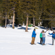
Surveyors with the California Department of Water Resources recorded 50 inches of snow and a “snow water equivalent” of 18 inches on January 31 at Phillips Station, where DWR has conducted manual snow surveys for decades.

This was the second of five snow surveys planned for this winter. More than 50 agencies at the local, state and federal levels collaborate on the Cooperative Snow Surveys Program to collect snow data from more than 300 locations statewide each year. Results from these surveys are crucial to water management in California.

The most recent survey at Phillips Station showed the snowpack as 98 percent of average to date – just shy of the statewide average. By comparison, on February 1, 2018, measurements at Phillips Station showed a snow water equivalent of 2.6 inches – just 14 percent of the early-February average. Snow water equivalent is a standard metric of how much water is held in snow.

In the Upper Colorado River Basin, conditions are slightly better than they are in California – a good sign for a region that has suffered nearly two decades of drought. Precipitation and snow water equivalent were both at 105 percent of average at the end of January.

No shortages are expected on the Colorado River system in 2019, though long-term drought conditions continue to be a concern across the Southwest.

San Diego well-positioned to meet regional water demands

The National Weather Service reports that between Oct. 1, 2018, and Feb. 6, 2019, San Diego County received more than nine inches of rain at Lindbergh Field, which was 165 percent of normal, and more than 11 inches of rain at Ramona Airport, which was 142 percent of normal.

“This winter is shaping up nicely,” said Jeff Stephenson, a principal water resources specialist at the San Diego County Water Authority. “A well-timed string of storms and cooler temperatures is allowing us to leave water in storage for use during the dry summer months – and it’s important that everyone continue to leave off their irrigation systems while there’s plenty of water in the soil.”

No matter how the winter plays out, the Water Authority and its 24 member agencies have enough water to meet regional water demands for the foreseeable future. This is made possible by a combination of investments in drought-resilient resources, including the Claude “Bud” Lewis Carlsbad Desalination Plant, conserved agricultural water transfers and continued water-use efficiency measures.

Lake Tahoe’s New Reality: Study Says Sierra Nevada Snowpack To Suffer Sharp Decline

Imagine Lake Tahoe with no snow year round. Every winter storm that reaches the basin brings only rain. No skiing. No snowboarding. No winter sports of any kind. As unpleasant and uncomfortable a thought it is, Tahoe is staring at a drastically different future. A dramatic decline in the Sierra Nevada snowpack will be felt the most in Northern California by mid century, according to a study published in December 2018 by the Department of Energy’s Lawrence Berkeley National Laboratory (Berkeley Lab).

San Diego’s airport reported 3.98 inches of rain between the start of the 2019 water year on Oct. 1 and Dec. 7, according to the National Weather Service. Photo: James Arnott, Flickr/Creative Commons License Wat

Late-Fall Storms Improve Water Outlook Statewide

San Diego welcomed an unexpectedly large amount of rain since mid-November, surpassing last year’s rainfall total in just the first 10 weeks of the season.

Following the latest storm, two-day precipitation totals on Dec. 7 showed rainfall of 2.6 inches at San Diego’s Lindbergh Field, San Diego’s official weather station. Regional readings ranged from a high of 3.23 inches in the University Heights area of San Diego, to 1.1 inches in Lakeside and less than an inch in the county’s desert areas.

San Diego’s airport reported 3.98 inches of rain between the start of the 2019 water year on Oct. 1 and Dec. 7, according to the National Weather Service.  Just over three inches of rain was recorded at Lindbergh Field between Oct. 1, 2017, and Sept. 30, 2018 – the second lowest total since 1850.

To put the water season in perspective, average rainfall at this time of year is about 1.8 inches.

Sierra Nevada Snowpack off to a Fast Start

In Northern California, late-fall storm systems have dropped a generous amount of snow in the Sierra Nevada, which had been very dry through mid-November. Many mountain areas are reporting twice the average snowpack for mid-December.

More than 60 percent of the state’s water supply comes from Sierra Nevada snowpack as it melts and releases water to lower elevations.  The more snow that falls each winter, the more protection the state builds against drought the following year. 

The news is also positive in the Rocky Mountains, though the Upper Colorado River Basin has been struggling with drought for nearly two decades. Rainfall was at 119 percent of average in mid-November.

San Diego Region has Sufficient Supplies for 2019

For San Diego County, the National Oceanic and Atmospheric Administration’s Climate Prediction Center’s three-month weather outlook for December through February predicts above-normal precipitation across all of California except the very northern tier. The agency also predicts above-normal temperatures for the western states, with a greater than 40 percent probability of above-normal temperatures this winter statewide.

Even if weather conditions were to dry out through September 2019, the Water Authority and its member agencies have enough water supplies to meet regional demands for the foreseeable future. This is possible due to a combination of drought-resilient local and regional water resources, including the Claude “Bud” Lewis Carlsbad Desalination Plant, conserved agricultural water transfers, savings from canal lining projects, and continued water-use efficiency measures.

A weak El Nino is expected to form and continue in the Northern Hemisphere this winter and into the spring. As a result, the U.S. Seasonal Drought Outlook released on Nov. 15 favors drought improvement or removal for California and the southern portion of the Southwest.

Meteorologist Alex Tardy of the National Weather Service San Diego office predicted near-average precipitation in the region in his 2018-2019 outlook, noting that “past precipitation events have been extreme” with extended dry periods between storm patterns that bring heavy rain.