It has been a winter – and spring – for the record books, for California reservoirs and ski resorts. And, it’s not over yet.
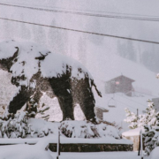
Snow has continued to fall throughout May, with several inches or more in the Sierra Nevada and the southern California mountains.
In the lowlands, the City of San Diego has experienced one of its wettest months of May on record. The San Diego National Weather Service reported that Alpine and El Cajon set daily precipitation records on May 23.
The normal rainfall at Lindbergh Field during the water year (October 1 – September 30) averages about 10.3 inches. In the current water year, 12.7 inches of rain has been recorded at Lindbergh Field as of May 23.
May snowfall in the Sierra Nevada
“It’s atypical to see the snowpack increase in May,” said Alexi Schnell, water resources specialist with the San Diego County Water Authority. “The impact of atmospheric river storms helped push snowpack levels in the northern Sierra to 172 percent of normal as of May 23.”
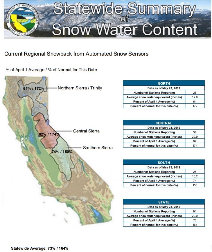
A bountiful year for snow continued into May in the Sierra Nevada. Graphic: California DWR
Record snowfall also allowed many ski areas, from Squaw Alpine to Mammoth Mountain, to extend their ski seasons into late-Spring, with fresh powder in May a bonus for skiers.
A May to remember at Mammoth Mountain
Mammoth Mountain tweeted that it has received 29 inches of snow as of May 23, “officially our snowiest May on record, beating out May 2015.” (Video courtesy of Mammoth Mountain).
Major reservoirs near capacity
Many of the state’s major reservoirs are near capacity and are significantly above their historical averages as of May 23. Lake Shasta is at 97 percent of capacity and at 113 percent of its historical average.
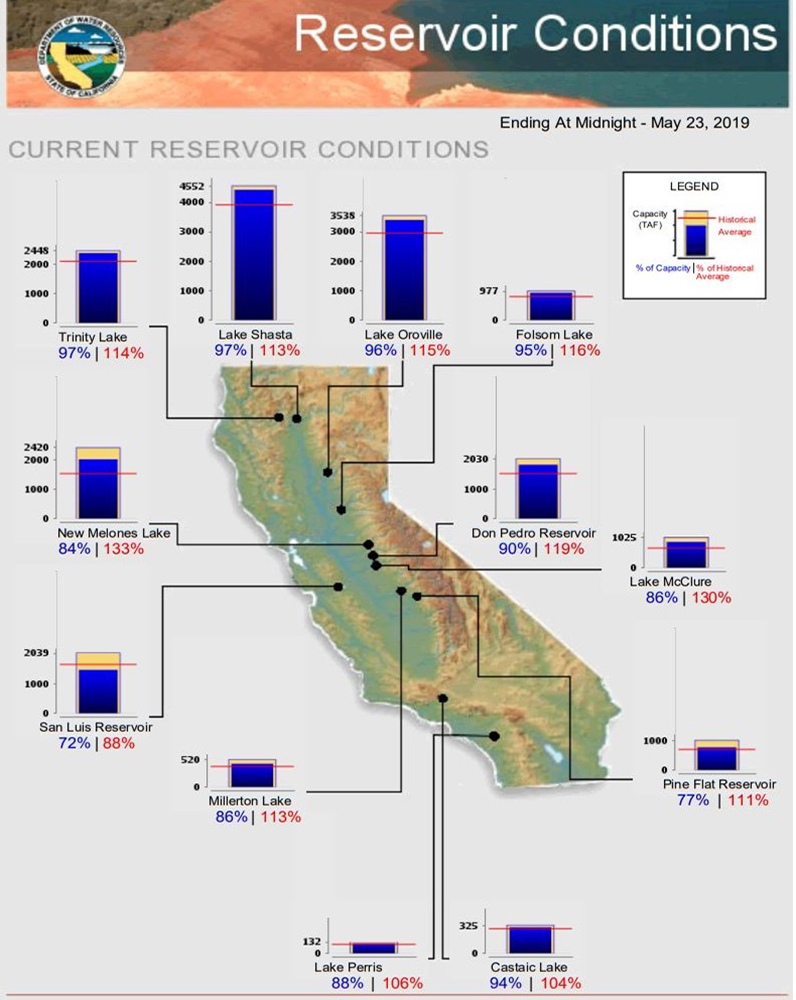
Most major California reservoirs are near capacity and significantly above historical averages for May 23. Graphic: California DWR
Summer is coming
Schnell cautions that this current water year is an exception, and the climatological cycle in California can bring several consecutive years of drought, like the 2015-2017 period, which prompted mandatory water-use reductions.
While the winter and spring has been ‘atypical,’ the summer could set some records too.
“Looking ahead over the next three months, the National Weather Service forecast shows that there is a greater than 50 percent chance the region will be warmer than normal,” Schnell said.
NWS Climate Prediction Center three-month temperature outlook. Graphic: NWS/NOAA