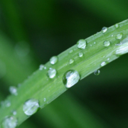
Late-Fall Storms Improve Water Outlook Statewide
San Diego welcomed an unexpectedly large amount of rain since mid-November, surpassing last year’s rainfall total in just the first 10 weeks of the season.
Following the latest storm, two-day precipitation totals on Dec. 7 showed rainfall of 2.6 inches at San Diego’s Lindbergh Field, San Diego’s official weather station. Regional readings ranged from a high of 3.23 inches in the University Heights area of San Diego, to 1.1 inches in Lakeside and less than an inch in the county’s desert areas.
San Diego’s airport reported 3.98 inches of rain between the start of the 2019 water year on Oct. 1 and Dec. 7, according to the National Weather Service. Just over three inches of rain was recorded at Lindbergh Field between Oct. 1, 2017, and Sept. 30, 2018 – the second lowest total since 1850.
To put the water season in perspective, average rainfall at this time of year is about 1.8 inches.
Sierra Nevada Snowpack off to a Fast Start
In Northern California, late-fall storm systems have dropped a generous amount of snow in the Sierra Nevada, which had been very dry through mid-November. Many mountain areas are reporting twice the average snowpack for mid-December.
More than 60 percent of the state’s water supply comes from Sierra Nevada snowpack as it melts and releases water to lower elevations. The more snow that falls each winter, the more protection the state builds against drought the following year.
The news is also positive in the Rocky Mountains, though the Upper Colorado River Basin has been struggling with drought for nearly two decades. Rainfall was at 119 percent of average in mid-November.
San Diego Region has Sufficient Supplies for 2019
For San Diego County, the National Oceanic and Atmospheric Administration’s Climate Prediction Center’s three-month weather outlook for December through February predicts above-normal precipitation across all of California except the very northern tier. The agency also predicts above-normal temperatures for the western states, with a greater than 40 percent probability of above-normal temperatures this winter statewide.
Even if weather conditions were to dry out through September 2019, the Water Authority and its member agencies have enough water supplies to meet regional demands for the foreseeable future. This is possible due to a combination of drought-resilient local and regional water resources, including the Claude “Bud” Lewis Carlsbad Desalination Plant, conserved agricultural water transfers, savings from canal lining projects, and continued water-use efficiency measures.
A weak El Nino is expected to form and continue in the Northern Hemisphere this winter and into the spring. As a result, the U.S. Seasonal Drought Outlook released on Nov. 15 favors drought improvement or removal for California and the southern portion of the Southwest.
Meteorologist Alex Tardy of the National Weather Service San Diego office predicted near-average precipitation in the region in his 2018-2019 outlook, noting that “past precipitation events have been extreme” with extended dry periods between storm patterns that bring heavy rain.